Showing posts with label river. Show all posts

Sunday, October 12, 2014

Salisbury holiday 2014

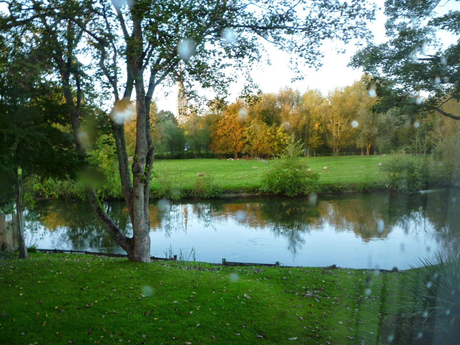
Last week we had a few days away in Salisbury, staying at the very comfortable Rose and Crown Hotel. This was the view from our hotel bedroom, straight out onto the River Avon, with Salisbury Cathedral just visible through the trees. The restaurant was also on the banks of the river, and we enjoyed having our breakfast looking out over it. We ate in the hotel one night too, but it was too dark to see anything then!

The hotel was 10 minutes walk from the city centre (about 20 minutes' walk from the railway station), or a longer route over the water meadows with beautiful views of the cathedral on the other side.


We'd already done some exploring when we visited Salisbury for the day whilst we were on holiday in June, so we quickly got reacquainted with the city centre. This is one of the routes out from the Cathedral Close.
On the first day, after we'd got settled into the hotel, we visited Mompesson House, an 18th century National Trust property within the Cathedral Close. The Sense and Sensibility film starring Emma Thompson and Kate Winslet was filmed here back in 1995, so some parts may look a bit familiar.


There was a modern sculpture exhibition on inside the house, which included the occasional knitted/felted object too.


The rooms were all beautiful, and it was fairly quiet so easy to see everything and photos (without flash) were allowed. This is the OH looking at some of the books in the library. There are more photos of Mompesson House on Flickr.


On the full day of our holiday we decided to visit Stonehenge, after lots of umming and ahing as the only way to get there by public transport is on the Stonehenge Tour bus, which costs £14 for an adult! In the end we decided to go, as we could get free admission to Stonehenge itself as we're National Trust members. Otherwise the outing would have cost nearly £60, which would have really put us off going. I was also interested to see what they'd done to Stonehenge, as I knew a new visitor centre had been opened.

Stonehenge was actually better than we'd been expecting. The visitor centre building is a bit jarring and modern, but isn't within sight of the stones. More importantly it houses plenty of loos(!), a café, a very over-priced shop and an exhibition. Outside, there are a few replica neolithic houses to go inside. The exhibition was quite good, if not very big. It was definitely designed to get as many people through in as little time as possible!


The stones are a short distance away, and you can either walk to them, or catch a shuttle bus/land train. As it was rather a wet and windy day, we caught the bus. There is an accessible path up to the stones, and then plenty of space to walk around them, with good views of the stones, both reasonably close to, and further away. I know some people were complaining that they couldn't actually go up to the stones themselves, but that seems a bit unrealistic considering the fragile ground and the number of visitors. Also, seen like this, it was possible to take good pictures of the stones without people in the way.


Halfway round viewing the stones it started raining in earnest so we got totally drenched!! There is no shelter at the stones themselves, so we just carried on walking round them, then caught the bus back to the visitor centre! It was very windy so the rain was blowing sideways. Always fun. There are more photos from Stonehenge on Flickr.


On our way back towards Salisbury the tour bus stops at Old Sarum, which was what we'd really come to visit. This is the original site of the city, and was an Iron Age hill fort, and where the castle and first cathedral once stood, but the site had little access to water and was abandoned in the 13th century in favour of the current site of Salisbury. It's easier to get a sense of the site from the aerial photo on the Old Sarum website.

This is the view from near the entrance, over towards Salisbury itself. The site was first used in the Iron Age, and first appears in documentary records during the Roman occupation. After the Conquest, William the Conqueror built the castle on the site.


Inside the castle, the remains of the Courtyard House. The walls were demolished when the city was abandoned, and the stone taken away to use in building the new Salisbury.


This is the view from what remains of the ramparts, to the remains of the cathedral. The first cathedral was begun in 1075, but was damaged in a thunderstorm in 1092, only five days after it was consecrated. Work on the extended cathedral began in 1130. I found it rather odd that they put so much work in over so many years, only to move the cathedral (and tombs) to the new Salisbury site in 1226.


There are more photos from Old Sarum on Flickr.
And that was about it. We returned to Salisbury for another night at the hotel, before catching the train back to Staines the next day.

Wednesday, February 12, 2014

More flooding 2014

After the flooding last month, the waters went back down again and everything carried on as normal. Except the rain carried on, and more and more water piled down the Thames, and since the weekend the flood waters have risen again. It's been a lot worse this time, and several of our friends have had to leave their homes. Ours is absolutely fine, and we've just had a few problems getting to work (road closures and trains not running) but so far have been able to pretty much function as normal.

It has however been very strange seeing the area we live in plastered all over the news, and visited by every politician possible (wearing an array of wellies).

 This road leading to the park is becoming one with the Thames.


 Flooded multi-storey car park on the banks of the Thames.
 This is normally a semi-circular seating area on the banks of the Thames, but the river's now so high all the steps/seats are under water!
 The road under the railway bridge is now closed to traffic, although pedestrians can still walk that way as the Thames is only(!)  halfway across the road.
River Colne going through the Two Rivers shopping centre. It's usually well over a metre below this level. That's a good name for a shopping centre...

Friday, January 17, 2014

Bobble man

I got Bobble Man finished - with a bit of a wild hair-do. May be Bobble Woman now, but I think I'll leave him/her as non-gender-specific!

Bobble Person is going to the same charity as the previous toy I knitted, which teaches RE in nursery and primary schools. I'll need to make him/her a friend at some point, so that the kids have a pair to act out the story of the man who built his house on the rock.

Bobble Man the pattern is quite a fun knit. It's in the round, so the finishing isn't too horrendous, although you have to keep your mind on what you're doing as it's easy to do the bottom half of the body at 90° angle to the top half. That looked a bit strange. The hair I added, using the technique outlined in this blog post about creating Harry Potter characters. It takes a surprising amount of yarn to do the hair for one toy!


I'm making great progress on my first stash busting project, the chunky yarn pattern. This is the Lima cardigan in Mirasol Sulka. The yarn is ovely to knit with and the cardigan's coming together fast because it's on 6mm needles. So even the moss stitch isn't taking too long.


And, yes, I have ordered more yarn, in the 10% off New Year sale from GetKnitted. But this is for a definite project, another hooded jumper for my nephew's birthday - in his favourite colour. Despite being acrylic the Supersoft Aran feels soft and not squeaky to knit with, plus it wears really well (I used it for two jumpers for my nephews three years ago, and they're still going strong, although getting a bit small now).


Thank you for the comments about flooding in my previous post. Fortunately the water has gone down now (bizarrely fast, as though someone had pulled the plug out!), although everywhere is still very wet.

Saturday, January 11, 2014

Flooding 2014

So, the year got off to a great start with more and more water heading down the Thames. There was some flooding in the area last year, but nowhere near as bad as this, and it felt like we'd had much worse weather last year too. These are some photos I took out and about in the last couple of days:

Staines Bridge is still open (unlike Chertsey Bridge) , but as you can see from the line of streetlights in the river, the Thames path is completely under water.


This is normally a lower platform thing with steps and ramps you can go down to have a closer look at the river. Last year the river went into the bottom of it, and part way up the steps, but this is nearly at the top!


This road's gone completely under water too. I drove through there three days before this photo was taken (in a car that had also broken down earlier that day!). Who ever parked their car down there wasn't very sensible... To the right of the picture is actually usually a park, rather than a lake.


This is the park. The mud in the foreground is actually a car park. The rest of it is usually grass, and that is the top of a children's playground you can just see sticking out from the water.


The river's still rising, so the flood levels will be up a bit more. We *should* be OK where we are...
 I've put more pictures of the flooding in my photostream.

Saturday, December 29, 2012

High water

Back in November the Thames got very high and I took some photos, intending to blog about it and never got round to it. This is the path in the local park leading down to the Thames path. The benches and rubbish bins were just about visible (it had been a bit higher than this).


It rained a lot whilst we were away. Up north (well midlands) there were a lot of rivers that had turned into lakes. North of Bedford the Great Ouse had oozed spectacularly for miles on either side of the road. On the Notts/Lincs border the Trent was so wide you couldn't see the other side. We had a day trip to Lincoln on Boxing Day and must have been one of the last cars over Dunham Bridge on the A57 before the road was closed. Our side of the road was clear at that point, but the other side was under water. There's a picture of it on the BBC website totally under water.

And this is what we came back to when we got back home after Christmas away. I couldn't even get close to the no BBQs sign this time.


And the park seems to have turned into a lake.


I don't think this is what was intended by "overflow car park".

Further up the river, this is Staines bridge, and what was the Thames path running outside a pub with seats for people to admire the river view.


And the Thames path a bit further up again. Yes, the river is usually to the right of the trees and lamp posts.

Fortunately most of these places aren't too near anyone's house, although the river's showing no signs of going down yet, and it's been raining all of today. Our house is well away from it.